Top 5 Trail-Hiking in Provence-Alpes-Côte d'Azur
The Provence-Alpes-Côte-d'Azur region has it all: mountains in the background, the Mediterranean Sea and the mild weather of the south of France. It is also a region blessed by the Gods for trail running and hiking. To help you discover it if you are not from this region, we have put together a small selection of Trail-Randos to discover with our Top 5 Trail-Randos in PACA. This selection includes Trail-Randos near magnificent and emblematic places in this region such as Mont Ventoux, the Calanques or the Côte d'Azur. These 5 Trail-Randos are also routes where renowned Trail races in the region take place. It's up to you to choose whether you want to discover them during these Trail races or at your leisure and at your own pace on another date. One thing is certain: you will come back excited and asking for more.
Preparation and equipment
If you decide to venture on these Trail-Rando routes outside the dates of the Trail races that take place there, here is a reminder of some preparation tips before your Trail-Rando. First, you must carefully assess your current physical condition and not overestimate yourself, especially in relation to the distance or the cumulative elevation gain targeted. Then, you must recognize the route online if you have never been there before, by studying the elevation gain or by identifying possible water or refreshment points (village/small town). Also, do not forget to bring your charged mobile phone to find your way or, if necessary, to be able to call for help in the event of a problem or unforeseen event. Finally, in terms of equipment, don't forget the 'essentials' for a successful Trail-Rando, namely suitable shoes, technical clothing (ultra light with breathable materials and several layers including a waterproof jacket), a trail backpack, sunglasses, sunscreen, a headlamp and of course sufficient food and hydration depending on the planned duration of your Trail-Rando outing.
After these preparations, we are ready to set off on an adventure and discover the Top 5 Trail-Hikes in Provence-Alpes-Côte-d'Azur.
Galinette Trail (near Marseille)
4 courses: 12 km 800m D+ / 26 km 1350 D+ / 35 km 1900m D+ / 44km 2500 D+
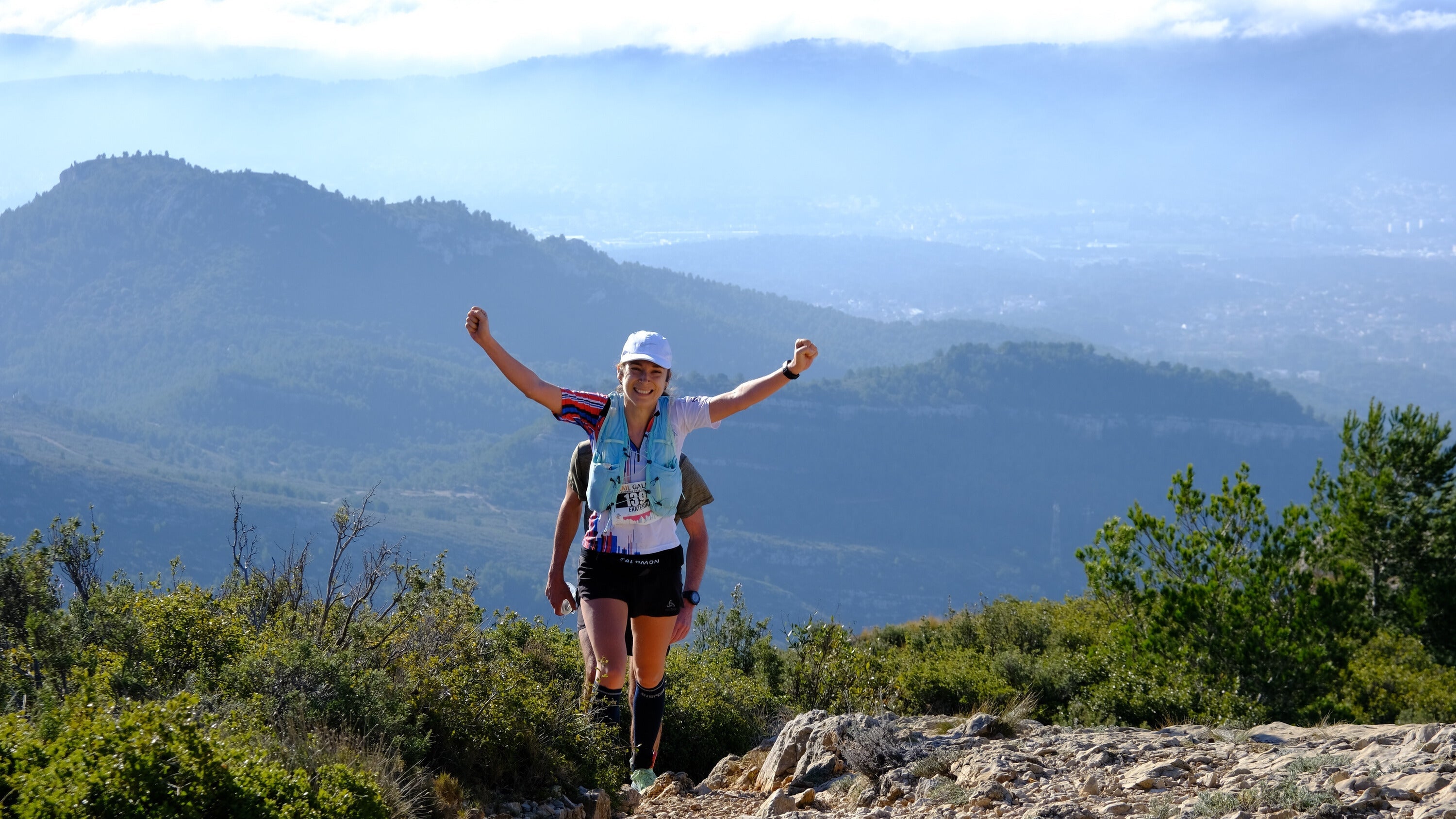
Organized by the Marseille Trail Club, the Galinette trail, which is already in its 21st edition, is an eco-responsible and friendly event, which takes place every year on the last weekend of January in Cadolive (20 minutes from Marseille). With 4 proposed routes, ranging from 11 to 44 km, this trail allows everyone to come and marvel at the breathtaking views of Marseille, Sainte-Baume and Sainte-Victoire while exploring the landscapes and paths of Garlaban and Mont Saint-Julien, made famous by Marcel Pagnol. But these are not the only charms of this trail. Known for its technical and playful routes, the Galinette Trail also opens the Challenge des Trails de Provence in the Region every year, all in a warm atmosphere supported by the large team of volunteers. An institution in the Region!
The new Drailles de la Galinette route (44 km) is shared with that of the "Brèche du Mont Julien" (35 km) up to the Col de l'Amandier. After the first 3 kilometers in Cadolive, things get serious with a beautiful climb towards the summit of Mont Julien to take you to the ridges. And it will last 2.3 km! Take the opportunity to enjoy the breathtaking views of Marseille, Sainte Baume and Sainte Victoire (if the weather is good). A refreshment point awaits you at the bottom of the descent after 9.5 km of racing. At this point, the peak of Taoumé is only a few meters away as the crow flies, but there are a few stages to pass before: the summit of Escaouprés, the Summit of Grande Tête Rouge, the climb via the Pas du Loup and the Grotte du Grosibou. It's going to sting, we warned you... A refreshment stop awaits you at the Col de Baume Sourne (23 km - 1600d+) to regain your strength to tackle the long descent then the climb back up the Pas de Garrige which leads to Garlaban, the highest point of the race. That's it, the hardest part is done! A last refreshment stop (38 km - 2300d+) in the Pichauris park and rush (or at least do your best) towards the finish!
Trail of the Balcons d'Azur (near Cannes)
3 distances: 23 km 900 D+ / 47 km 2200 D+ / 68 km 3200 D+
Located less than 10 minutes from Cannes, in the heart of the Esterel massif, it is with your feet in the water that the town of Mandelieu la Napoule invites you to come and intoxicate yourself with the scents of pines, heather and rosemary. An unmissable jewel of the Côte d'Azur, this low-altitude mountain range, composed of volcanic rocks which give it its reddish color, has established itself as the unique and magical site of the Trail des Balcons d'Azur which is in its 8th edition. A true belvedere overlooking the bay of Cannes with the Alps and the Lerins Islands as a backdrop, the majestic beauty of the course is made up of tracks, paths, and 70% of trails with an exceptional panorama along the deep blue sea in a still preserved nature.
Calanques Trail (between Marseille and Cassis)
3 distances: 19km 1000 D+ / 36km 2000 D+ / 56 km 3000 D+
The Trail des Calanques has already 36 years of history and is managed by the Marseille-Provence section of the CAF (Club Alpin Français). The next edition will be the occasion of 2 anniversaries, the 40th edition of the Trail des Calanques and the 150th anniversary of the organizing club, the CAF. This event was created in 1985 and the objective at the time was for it to serve as training for the mountaineering season. The Trail des Calanques has obtained authorization from the Calanques National Park to perpetuate this event in the heart of the park, while limiting participation to 100 runners per course. Since the 2020 edition, it has been divided into 3 courses on marked trails, to promote sport for all and respond to the increase in the level of trail enthusiasts, the longest and most technical (56km and 3000m of D+, D-) being qualifying for the ITRA events (Ultra Trail du Mont Blanc, 2 points). The Calanques trail starts from Luminy and arrives at Parc Pastré. It is part of a strong environmental commitment and an eco-responsible organization thanks to the commitment of more than 120 volunteers and close coordination with the Calanques National Park and the various institutions involved (ONF, town halls of Marseille and Cassis, department, etc.).
Haute-Provence Trail (north of Aix en Provence)
7 distances: 10km 360 D+ / 18km 720 D+ / 28km 1200 D+ / 52km 2300 D+ / 80km 3450 D+ / 120 km 5800 D+ / 160km 7200 D+
Halfway between the Alps and the Mediterranean, between Lure and Lubéron, the Pays de Forcalquier-Montagne de Lure forms the magic square of Haute Provence. Sometimes harsh and wild, sometimes gentle and serene, it is the diversity of its reliefs that gives it its charm and generates a constantly renewed pleasure in the visitor. In 2024, it will already be 10 years of life-size adventure for the Trail de Haute Provence. A superb opportunity to come and discover or tackle its legendary trails again and climb the lunar landscapes of the Montagne de Lure to feast your eyes on its 360° panoramas, or hurtle down into its magical undergrowth to arrive at the Abbey of Notre-Dame de Lure and its giant trees, and finally slalom between the thousand-year-old stone faces of the Mourres before the final stretch to reach Forcalquier! As always, the THP team and its volunteers will welcome you in a family and festive atmosphere. With no less than 7 distances ranging from 10km to 160km, there is something for all tastes and abilities.
mythp.fr/trail-de-haute-provence/
Ventoux Trail (northeast of Avignon)
4 distances: 15 km 430 D+ / 29 km 1550 D+ / 46 km 2350 D+ / 75 km 3900 D+
Since 1990, Mont Ventoux, the Giant of Provence, has been a UNESCO World Biosphere Reserve for the great wealth of its natural and cultural heritage. It is also a privileged space for outdoor sports. It is In this exceptional environment, the Ventoux Trail travels, starting from Bedoin, taking the wildest paths to reach the legendary summit at an altitude of 1912 m.
The summit passage is always a great moment, especially since the conditions can be very changeable, sometimes even forcing the race management to make last-minute decisions in order to best guarantee the safety of the runners. It is not uncommon to find snow on the summits and ridges at the end of March while the almond trees are already in bloom at the bottom. This is one of the specificities of this event. A start in an often spring-like atmosphere, on paths and trails crossing the colored ochres and surveying the paths on the border between the South face and the North face, it is at this point in the race a typically Provençal Trail. Then after the separation of the two courses at 1400m, those who continue towards the summit enter the world of high valleys and ridges. Then begins a mountain Trail, in a magnificent environment. Once you have reached the summit, you will have to cover 5 kilometres along the ridges along the edge of the dizzying northern valleys with the entire Alps chain as a backdrop to the north, while to the south in good weather you will make out the sparkling Camargue ponds and the Mediterranean. After passing the second refreshment point, you will dive into the wild Grave valley to join the GR 91 B which crosses the entire southern face, passing from Jas to Jas, these old sheepfolds typical of the area. You will then find yourself on the Piedmont trail, with these last undulations between pine forests, vineyards, olive groves and truffle fields to complete this great route and cross the finish line in front of the towers of the Florans estate.
5 trail running or trail hiking routes in places that rival each other in beauty in this superb Provence-Alpes-Côte-d'Azur region. You are spoiled for choice. All you have to do is choose your trail running or your trail hiking route to discover what the PACA region has to offer for trail and hiking enthusiasts. One thing is for sure: you will not be disappointed by the trip, a little tired for sure but fulfilled!
Many thanks to Régis, from the organizing committee of the Trail de la Galinette for his help in preparing and writing this article.


Leave a comment
This site is protected by hCaptcha and the hCaptcha Privacy Policy and Terms of Service apply.